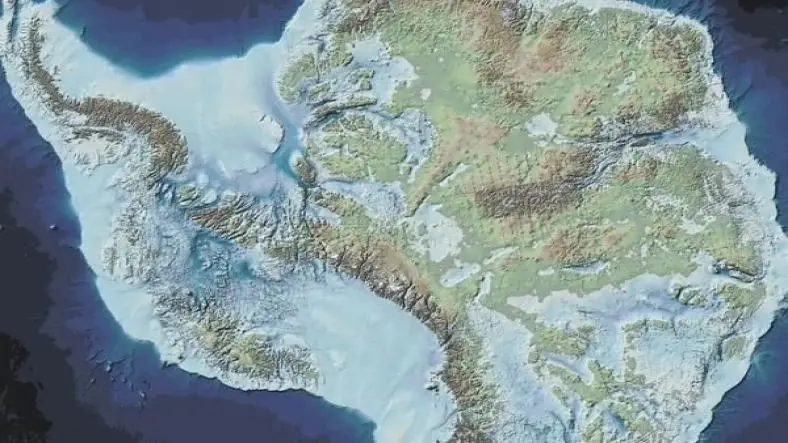
The Piri Reis Map, created in 1513 by Ottoman admiral and cartographer Piri Reis, has fascinated historians, scientists, and conspiracy theorists for decades. What makes this map so mysterious is its alleged depiction of Antarctica’s coastline – without ice, centuries before the continent was officially discovered and explored.
Drawn on a piece of gazelle skin parchment, the map shows parts of Europe, Africa, South America, and an area that some claim resembles Antarctica's northern coastline, but without the thick ice cover present today. This strange detail has led many to question the origins of the knowledge behind the map, sparking debates over lost civilizations, ancient exploration, and advanced technologies.
Who Was Piri Reis?
Piri Reis was an accomplished Ottoman naval officer and geographer, best known for his book “Kitab-ı Bahriye” (Book of Navigation). In 1513, he compiled his famous world map using a variety of earlier sources, including:
- Maps from ancient Greece and Rome
- Arab and Portuguese maps
- Even a claimed map from Christopher Columbus, now lost
He explicitly noted on the map itself that it was drawn using about 20 different source maps, some of which were ancient and no longer existed by his time.
What Does the Map Show?
The surviving portion of the Piri Reis Map is only the western half, but it features:
- The western coast of Africa
- The eastern coast of South America
- A mysterious southern landmass that some believe is Antarctica
The detail that has intrigued many is that this supposed Antarctic coastline appears to be free of ice, suggesting knowledge of the continent’s shape prior to its glaciation – something that modern science has only been able to determine with satellite imaging and seismic surveys.
The Antarctica Connection – Myth or Fact?
Supporters of the map's mysterious reputation claim the following:
- The map shows Queen Maud Land, a part of Antarctica, with its true coastal shape.
- This area has been under ice for thousands of years, suggesting that the original sources used by Piri Reis came from a time when Antarctica was ice-free.
- If true, this would mean that an unknown ancient civilization had advanced navigational and cartographic knowledge far beyond what history currently acknowledges.
However, mainstream scholars and cartographers argue:
- The landmass in question could be a distorted representation of South America, not Antarctica.
- Cartographic errors and artistic liberties were common in early maps.
- There is no solid evidence that ancient civilizations had access to detailed knowledge of Antarctica.
Scientific Counterarguments
Geologists and climatologists point out that:
- Antarctica has been covered in ice for over 30 million years.
- There is no credible scientific data suggesting any human civilization existed far back enough to observe or map it ice-free.
- The “ice-free” interpretation of the coastline is subjective and not consistent with known geography.
Thus, while the resemblance may be intriguing, there’s a strong possibility that the map’s southern landmass is a misinterpreted or incorrectly drawn feature.
Theories and Speculation
Despite skepticism from the academic community, several alternative theories persist:
- Ancient advanced civilizations like Atlantis may have existed and had access to global mapping.
- Alien intervention or ancient extraterrestrial contact helped early humans develop advanced knowledge.
- The map is evidence of pre-Ice Age maritime civilizations that explored the world and documented it.
These theories remain speculative and are largely unsupported by archaeological evidence, yet they continue to fuel interest in the Piri Reis Map.
Why Is the Map Still Important?
Even without the Antarctic mystery, the Piri Reis Map is a remarkable artifact:
- It’s one of the earliest known maps to accurately show the Americas.
- It provides insight into 16th-century geographical knowledge and mapmaking techniques.
- It demonstrates the way cartographers of the time combined knowledge from various cultures, including classical antiquity and Islamic scholars.
Conclusion
The Piri Reis Map remains one of history’s most debated cartographic artifacts. While mainstream science rejects the idea that it proves early knowledge of Antarctica, the mystery continues to captivate those interested in lost history and ancient knowledge. Whether it is evidence of forgotten civilizations, a misinterpreted drawing, or simply a product of its time, the map continues to invite speculation and inspire curiosity about the limits of ancient exploration.
Thanks for reading the article, for more unsolved mysteries related articles read our peoples blog articles.


